Scientists Used Aerial Imaging And A Map From 1868 To Prove That Beaver Dams Can Endure For Centuries, With 72% Of The Mapped Dams Still In Tact Over 150 Years Later

The beaver may be small, but it is also tough. Once prized for its pelt by the Europeans, the animals were hunted almost to extinction. However, their populations managed to bounce back, showing incredible endurance in the face of threats.
Beavers are also known for their industrious spirit, building durable dams that last for centuries and have the ability to change the American landscape.
This was made evident through a map from 1868, which was created by Lewis H. Morgan, a pioneering American anthropologist who also worked as a railroad lawyer. In the 1860s, he arrived in Michigan’s Upper Peninsula to direct the construction of a new railway.
When he came across a “beaver district,” he was amazed. He spent several years studying the beavers in the area now known as Ishpeming and published a book in 1868 called The American Beaver and His Works.
The book included a map that portrayed a roughly 50-square-mile plot of land crisscrossed with rail lines and dotted with settlements, mines, streams and the 64 beaver dams and ponds that Morgan studied. In 2018, experts took a look at Morgan’s map and realized that most of the beaver dams he had recorded were still standing.
An ecologist named Carol Johnston was curious to see how the dams fared approximately 150 years later as the area opened up to human development. The study would also provide an opportunity to learn more about the long-term resilience of beaver populations and the structures they build.
Johnston used aerial photographs to piece together a modern version of Morgan’s map. She found evidence that about 72 percent of the dams and ponds that Morgan documented were still intact.
At least one pond on Johnston’s map was larger than Morgan’s, suggesting that it had been expanded by beavers over time. Some sites contained dams that seemed abandoned, but the habitats were still visible.
Only 18 sites from Morgan’s map could not be found today. Some may have been covered by forest growth, while others were probably destroyed by human activity. Even so, Johnston is impressed with the strength and durability of beaver dams.

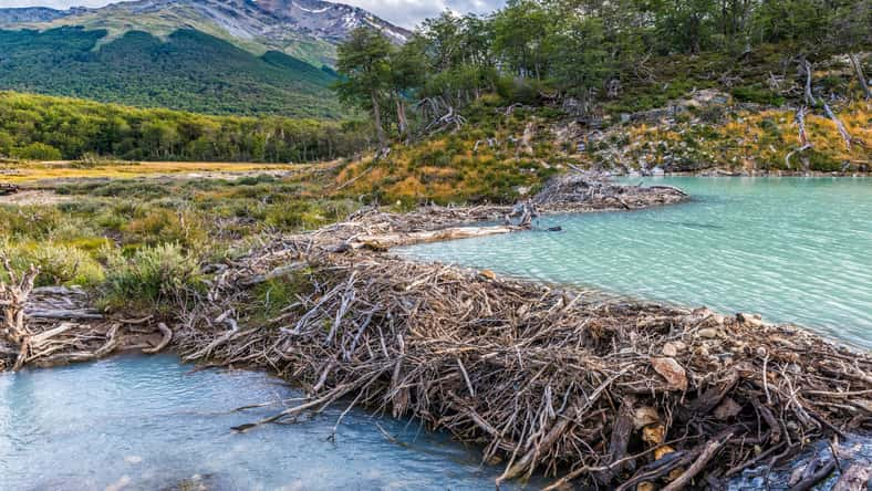
Fyle – stock.adobe.com – illustrative purposes only
Other research has indicated that some dams experience even longer lifetimes. For example, in 2012, a study found that a handful of beaver dams in California dated back to over 1,000 years old.
One of the dams was built around 580 A.D., and evidence shows that it was still in use and had undergone repairs around 1730. Finally, it was abandoned for good in 1850—over 1,200 years after it was first constructed.
Beavers are a very important species because they create, modify, and manage the habitats they live in. They have a significant impact on the biodiversity of an area, keeping our ecosystems healthy.
Rather than destroying the territory around them to build their creations as humans do, they utilize natural materials to enhance themselves and the environment.
These hard-working creatures are a reminder that while we should embrace industriousness in our own lives, we must do so in a way that gives back to the planet.
Sign up for Chip Chick’s newsletter and get stories like this delivered to your inbox.
More About:Animals


